

New York City
An integrated design program for a World City
New York City's Department of Transportation appointed PentaCityGroup, led by City ID, to develop a citywide standardised wayfinding system known as WalkNYC.
WalkNYC is the most significant information design project to be undertaken in New York City in a generation, designed to link all transport modes and communication channels.
-
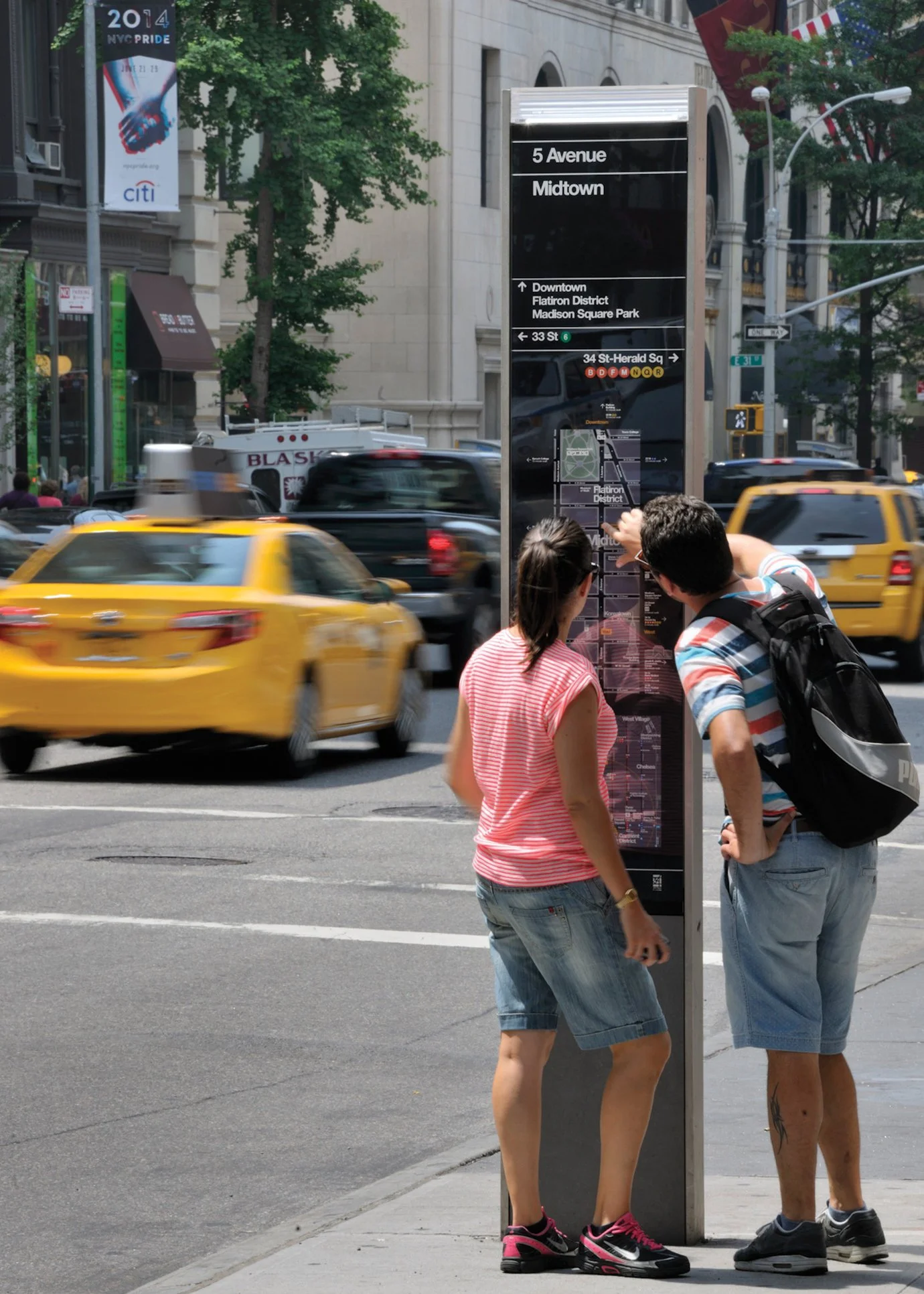
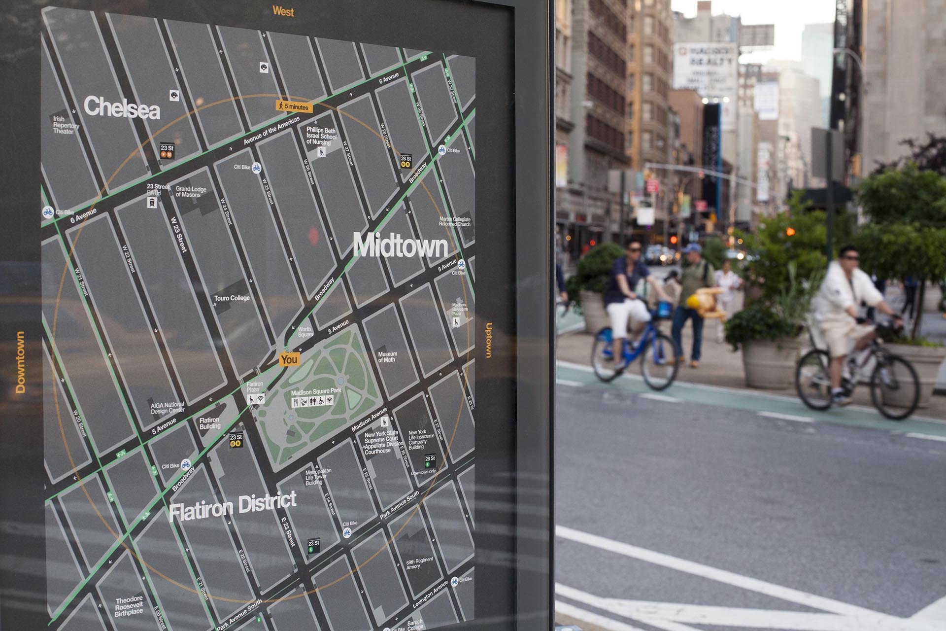
WalkNYC was designed to help the 8.5m residents and 50m visitors a year, to walk, bike and use public transit by providing new types of information as part of a standardized system of parts. The team created an intuitive, legible and extendable information system with an elegant family of products, robust design standards and a confident visual identity, all inspired by New York City and its iconic Subway system.
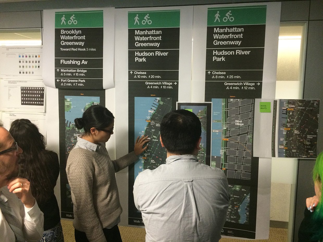
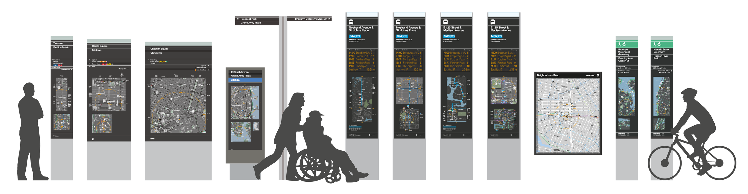
Building on the success of the WalkNYC, we tested and developed a range of improved information and product types, to integrate the city's wayfinding system within other modes of movement and transit. Outputs were developed and delivered for Bikeshare, Select Bus Service, Greenways, Penn Station and Grand Central Station, and print maps for the five boroughs. We also produced a range of templates and guidance documents for future roll-outs.
The program has fast become a benchmark for standardized wayfinding systems in North America.


NYCDOT Client
City ID Wayfinding, Graphic Design and Design Direction
Pentagram Graphic Design
Billings Jackson Design Industrial Design
RBA Group Engineering
T-Kartor Mapping
Notable projects
WalkNYC Pedestrian Wayfinding System
CitiBike
Select Bus Service (SBS) Transit Information
Greenways Wayfinding System
NYC Subway Neighborhood Maps
Visitor Maps
Design Standards and Guidance